EP01 - #RightNow Johannesburg: Zoo (Jan 10th 2020)
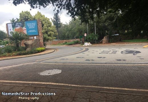
The zoo is dedicated to the accommodation, enrichment, husbandry, and medical care of wild animals, and houses about 2000 individuals of 320 species.
The Johannesburg Zoo has its origins as part of the Braamfontein farm which was owned by Hermann Eckstein. He had bought the farm to explore it for minerals and when he failed to find any, the land was converted as a timber plantation in 1891 called Sachsenwald after Otto von Bismarck.
After 1912 the zoo expanded into land that had been allocated in trust for a war memorial, the Rand Regiments Memorial for soldiers that died during the Second Anglo-Boer War.
From 1994 onwards, the zoo like others in South Africa begun to lose their government grants and so in 2000, the Johannesburg City Council corporatised the zoo and it became the Johannesburg Zoo Company with the Council as its main shareholder.
The Johannesburg Zoo is also the only zoo in South Africa to have successfully bred Siberian tigers, the largest cats in the world.
"Twist" the male Siberian, weighs 320 kg, and is the father of all the Siberian tigers to be found in South Africa. Max the gorilla was probably the zoo's best known resident.
Text: Wikipedia
Source Link: https://en.wikipedia.org/wiki/Johannesburg_Zoo
EP02 - #RightNow Johannesburg: Zoo Lake (Jan 10th 2020)
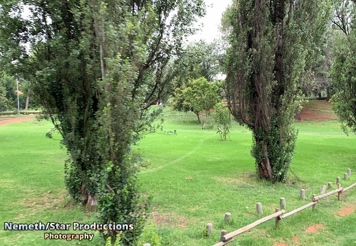
The Zoo Lake and public park is located in the north of Johannesburg. The area bought by banker and mining magnate Hermann Eckstein and hereby to the public 10 years after this dead in 1903. The land was given to the city of Johannesburg under the condition that the facilities were to remain open to people of all races, which was unusual in Colonial South Africa.
Text: Wikipedia
Source Link: https://en.wikipedia.org/wiki/Zoo_Lake
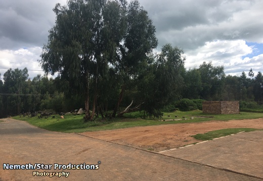
EP03 - #RightNow Dullstroom (Jan 17th 2020)
The town lies 35 kilometres north of Belfast and some 53 kilometres south-west of Lydenburg.
The town features the highest railway station in South Africa at 2,077 metres above sea level as well as at the foot of De Berg, the highest point in the province at 2,332 metres.
The area was occupied in the mid-19th century by the Southern Ndebele people under the rule of King Mabhoko. Like his son Nyabêla, Mabhoko used Mapoch's Caves as a hideout during conflict with troops of the South African Republic (ZAR).
Text: Wikipedia
Source link: https://en.wikipedia.org/wiki/Dullstroom
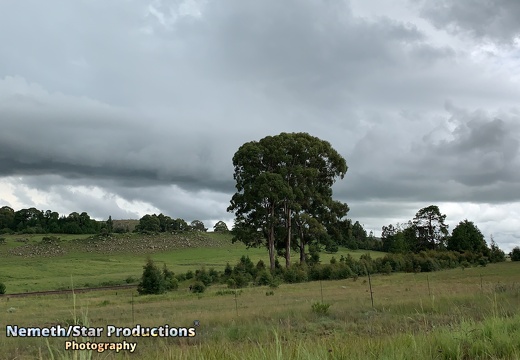
EP04 - #RightNow Graskop: The way to Graskop (Jan 20th 2020)
Graskop is a small town in Mpumalanga province, South Africa. It was set up in the 1880s as a gold mining camp but it now serves as a tourist destination and the timber industry.
The name is Afrikaans for grassy hillock. “God’s Window”, a scenic view from the escarpment of the Lowveld below, is located outside the town.
Graskop is 14 km south-east of Pilgrim's Restand 28 km north of Sabie. It was laid out between 1880 and 1890 on a farm belonging to Abel Erasmus, Native Commissioner of the Transvaal Republic.
Text: Wikipedia
Source link: https://en.wikipedia.org/wiki/Graskop
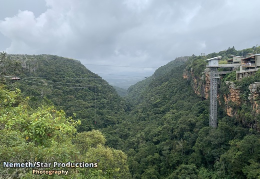
EP05 - #RightNow Graskop: The Big Swing (Jan 22nd 2020)
1.5 kilometres south of Graskop is one of 5 tourist attractions around the town located. The Big Swing combines fun for adrenaline junkies and forest lovers.
Next to the big waterfall adrenaline junkies can test their bravery by bungee jumping free-fall of 70 meters down into the Afromontane forest.
The Gorge Lift will bring you for a small fee down to the Afromontane forest in the gorge valley. A prepared walking path will lead your way close around the waterfall which water falls 138 meters in around 3 seconds.
Only 0.5 percent of the country area of South Africa are covered with Afromontane forest. Under the green canopy trees a wide range of plants, insects, animals and birds are homed.
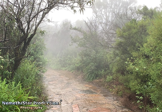
The area of the forest is generally wet and can be slippery at some sections. You may also meet some of the homed species here.
If you don't want to bungee jump then may choose the 135 meters long zip-line and fly 130 meters above the ground through the gorge. They may also give you the chance to drive through a strong fog like this one.
EP06 - #RightNow Graskop: God's window (Jan 24th 2020)
God’s Window is a popular vantage point along the Drakensbergescarpment, at the southern extremity of the Nature Reserve. Here, sheer cliffs plunge over 700 metres to the lowveld.
From this escarpment—a mostly unbroken rampart of cliffs—opens a vista into the lowvelt expanse and escarpment forests, the Eden-like aesthetic appearance of which prompted the name. On a clear day it is possible to see over the Kruger National Parktowards the Lebombo Mountains on the border with Mozambique.
God’s Window features prominently in the plot of the 1980 cult film The Gods Must Be Crazy.
The original Window is a rock that is set further back on a private farm and due to Quarry operations and tree plantation farming this actual rock that looks like a square window could not be used, therefore the site was moved by the government to the edge of the escarpment.
A viewing platform near the car park gives extensive views down the gorge to the plain below.
Text: Wikipedia
Source link: https://en.wikipedia.org/wiki/Blyde_River_Canyon_Nature_Reserve#God.27s_Window
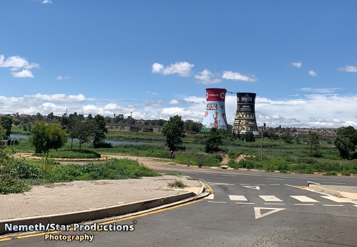
EP07 - #RightNow Johannesburg: Soweto Towers (Jan 28th 2020)
Orlando Power Station is a decommissioned coal-fired power station in Soweto, South Africa. The power station was commissioned at the end of the Second World War and served Johannesburg for over 50 years.
Planning for the construction of Orlando started in 1935, as the electricity demand of Johannesburg was rising faster than what could be met with the existing City Generating Station located in downtown Johannesburg. The location for the station was selected due to its proximity to water supply for coolant and railway lines for the delivery of coal.
Construction started in 1939 with Merz & McLellan as consulting engineers, but completion was delayed due to the outbreak of the Second World War. The last phase of construction was completed in 1955. The station was decommissioned in 1998 after 56 years of service.
The station was decommissioned in 1998 after 56 years of service. The two cooling towers are a prominent landmark in Soweto. Both towers are painted, one functioning as an advertising billboard and the other containing the largest mural painting in South Africa. The towers are also used for bungee and BASE jumping from a platform between the top of the two towers as well as a bungee swing into one of the towers.
Text: Wikipedia
Source link: https://en.wikipedia.org/wiki/Orlando_Power_Station
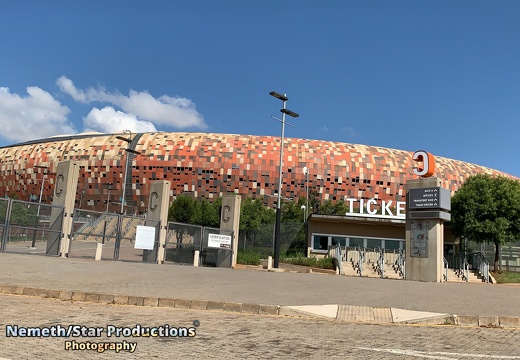
EP08 - #RightNow Johannesburg: Soccer City (Jan 28th 2020)
First National Bank Stadium or simply FNB Stadium, also known as Soccer City and The Calabash, is located in Nasrec, bordering the Soweto area of Johannesburg. The stadium is also known by its nickname "The Calabash" due to its resemblance to the African pot or gourd. The stadium has been officially known as FNB Stadium since it was opened in 1989. During the 2010 FIFA World Cup, as well as in the month before the tournament, the stadium was referred to as Soccer City. It was the site of Nelson Mandela's first speech in Johannesburg after his release from prison in 1990, and served as the venue for a memorial service to him on 10 December 2013.
Text: Wikipedia
Source link: https://en.wikipedia.org/wiki/FNB_Stadium
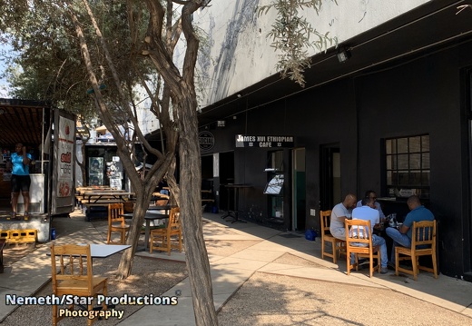
EP09 - #RightNow Johannesburg: Maboneng (Jan 31st 2020)
Like many cities around the world, there is an increasing focus on the rejuvenation of the inner city of Johannesburg. One of these initiatives is the Maboneng District located on the south-eastern side of the CBD
Originally a hub for art, it has expanded to include restaurants, entertainment venues and retail stores as well as accommodation and hotels.
Maboneng calls itself "a place of inspiration – a creative hub, a place to do business, a destination for visitors and a safe, integrated community for residents. A beacon of strength in Africa's most economically prosperous city".
Text: Wikipedia
Source link: https://en.wikipedia.org/wiki/Johannesburg
-------------
Agog is one if the common places in Maboneng's nightlife. Her you can chill and enjoy some wine. An Art gallery is connected to the bar as well and on the rooftop you have a bar for private parties.
The Marabi club is Maboneng most famous jazz club. The club opens around 6pm and is a mist see for jazz lovers or young couples who want to enjoy some time in a romantic atmosphere.
Named after the American rapper Jay-Z this rooftop with bar gives you an incredible view over Joburg.
The art on this street in Maboneng reflects the clothes school kids wearing during the last decades. Close to this street the community opened a skateboard park where the kids and everyone in the district can go to. This project takes the kids out of the street and supports the efforts to reduce the danger for kids to get criminals. Everyone who enters the skate park has to spend at least 2 hours there. 1 hour to have fun with skateboarding and 1 hour to learn a new skill.
Our Tour ends with the Collectors Treasury, the biggest collection of historic books about Johannesburg that still exists.
At the Curiosity Backpackers a typical rain storm in the south african rain time during summer starts and even ice is falling from the clouds.
-------------
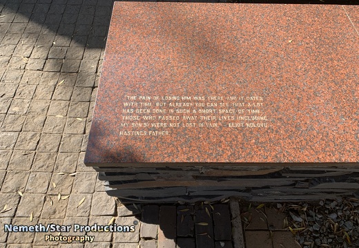
EP10 - #RightNow Johannesburg: Hector Pieterson Memorial (Feb 4th 2020)
Hector Pieterson was a South African schoolboy who was shot and killed during the Soweto uprising, when police opened fire on students protesting the enforcement of teaching in Afrikaans. The anniversary of his death is designated Youth Day, when South Africans honour young people and bring attention to their needs.
On 16 June 1976, school children protested the implementation of Afrikaans and English as dual medium of instruction in secondary schools in a 50:50 basis. This was implemented throughout South Africa regardless of the locally-spoken language and some exams were also written in Afrikaans. Students gathered to peacefully demonstrate, but the crowd soon became intimidated when the police arrived, and started to throw stones. The police arrived and fired tear gas into the crowd in order to disperse them.
Although the media often named Pieterson as the first child to die that day, another boy, Hastings Ndlovu, was actually the first child to be shot. But in the case of Hastings, there were no photographers on the scene, and his name was not immediately known. When Pieterson was shot, he fell on the corner of Moema and Vilakazi Streets. He was picked up by Mbuyisa Makhubo who, together with Pieterson's sister Antoinette, ran towards Sam Nzima's car. They bundled him in, and journalist Sophie Tema drove him to a nearby clinic where he was pronounced dead. On 16 June 2002 the Hector Pieterson Museum was opened near the place he was shot in Orlando West, Soweto to honour Pieterson and those who died around the country in the 1976 uprising.
Text: Wikipedia
Source link: https://en.wikipedia.org/wiki/Hector_Pieterson
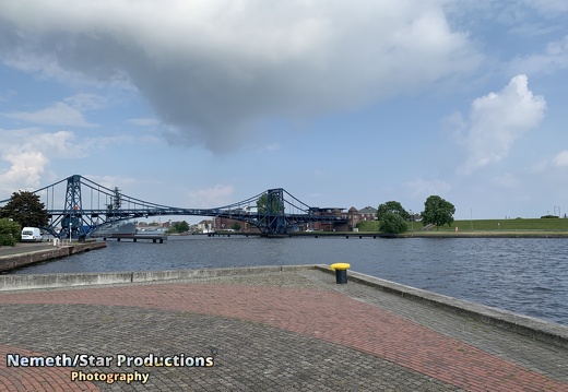
EP12 - #RightNow: Wilhelmshaven - Kaiser Wilhelm Brücke (June 15th 2020)
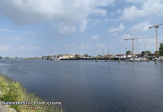
The Kaiser Wilhelm Bridge connects the beach (Südstrandpromenade) with the South Quarter.
Construction began in 1905, and at its completion in 1907 it was Europe's longest swing bridge. The design scheme was created by Ernst Troschel, construction was executed by MAN Nuremberg.
The bridge has a length of 159 metres (522 ft)and a width of 8 m. The two pillars are 20.4 m tall. The maximum passage height is 9.00 m at + 1.10 m medium water-level in the harbour, the passage width is 58.60 m.
On the bridge the road traffic can only drive one way at the same time. It is controlled by traffic lights.
Text: Wikipedia
More information about racism and colonialism in the German Kaiserreich here (German):
https://m.dw.com/de/rassistisch-r%C3%BCcksichtslos-grausam-die-deutsche-kolonialgeschichte/g-35991790
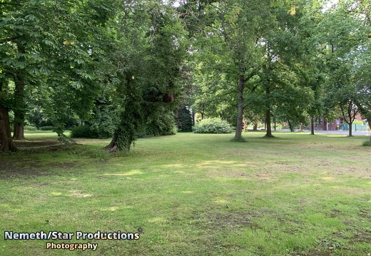
EP13 - #RightNow: Wilhelmshaven - Friedrich-Wilhelm Platz (June 15th 2020)
In 1869 King William I of Prussia (later also German Emperor) founded the town as an exclave of the Province of Hanover and a naval base for Prussia's developing fleet. All the hinterland of the city remained as part of the Duchy of Oldenburg.
Text: Wikipedia
More information about racism and colonialism in the German Kaiserreich here (German):
https://m.dw.com/de/rassistisch-r%C3%BCcksichtslos-grausam-die-deutsche-kolonialgeschichte/g-35991790
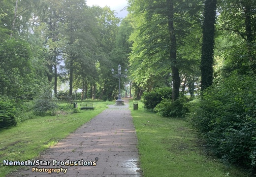
EP14 - #RightNow: Wilhelmshaven - Adalbertdenkmal (June 15th 2020)
Prince Adalbert of Prussia (Heinrich Wilhelm Adalbert) was a son of Prince Wilhelm of Prussia and Landgravine Marie Anna of Hesse-Homburg. He was a naval theorist and admiral. He was instrumental during the Revolutions of 1848 in founding the first unified German fleet, the Reichsflotte. During the 1850s he helped to establish the Prussian Navy.
In 1852 Adalbert argued that Prussia needed to build a naval base on the North Sea. He arranged the Jade Treaty of 20 July 1853, in which Prussia and the Grand Duchy of Oldenburg jointly withdrew from a region on the west bank of the Jade bay, where from 1854 onward Prussia established the fortress, naval base and city of Wilhelmshaven.
Text: Wikipedia
More information about racism and colonialism in the German Kaiserreich here (German):
https://m.dw.com/de/rassistisch-r%C3%BCcksichtslos-grausam-die-deutsche-kolonialgeschichte/g-35991790
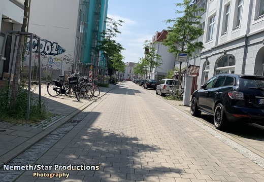
EP15 - #RightNow: Oldenburg (Oldb) (June 17th 2020)
Oldenburg is an independent city in the district of Oldenburg in the state of Lower Saxony, Germany. The city is officially named Oldenburg (Oldb) (Oldenburg in Oldenburg) to distinguish from Oldenburg in Holstein.
Archaeological finds point to a settlement dating back to the 8th century. The first documentary evidence, in 1108, referenced Aldenburg in connection with Elimar I (also known as Egilmar I) who is now commonly seen as the first count of Oldenburg.
In 1667, the town was struck by a disastrous plague epidemic and, shortly after, a fire destroyed Oldenburg.
After the German government announced the abdication of Emperor Wilhelm II (9 November 1918) following the exhaustion and defeat of the German Empire in World War I, monarchic rule ended in Oldenburg as well with the abdication of Grand Duke Frederick Augustus II of Oldenburg (Friedrich August II von Oldenburg) on 11 November 1918.
Sea salt production in the Oldenburg region has been used since the 15th century to supply the huge salt demand in the Baltic region. Peat extraction in the area continued for many centuries until it was replaced by coal mines.
Kultursommer (summer of culture), series of free musical and other cultural events in the city centre during summer holiday season in July.
Stadtfest, a three-day festival of the city centre in August/September, comprises gastronomical offerings and rock and pop music performances on various stages.
Oldenburg Central Station is at the intersection of the railway lines Norddeich Mole—Leer—Oldenburg—Bremen and Wilhelmshaven—Oldenburg—Osnabrück, with Intercity services to Berlin, Leipzig and Dresden and InterCityExpress services to Frankfurt and Munich.
Oldenburg is connected to shipping through the Küstenkanal, a ship canal connecting the rivers Ems and Weser. With 1.6 million tons of goods annually, it is the most important non-coastal harbour in Lower Saxony.
Bicycles play a very important part in personal transport.
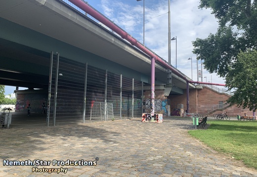
EP16 - #RightNow Frankfurt: Friedensbrücke (July 23rd 2020)
On February 19th a far-right extremest killed nine people in two shisha bars in Hanau. To remember this racism motivated terror attack a graffiti was drawn under the Friedensbrücke in Frankfurt to remember: Ferhat U. (23) just finished his apprenticeship Mercedes K. (35) waitresses, mother of 2, pregnant of a third Sedat G. (30), owner of Shishabar Midnight Gökhan G. (37), bricklayer and part-time waiter Hamza K. (20), was waiting for a friend, just finished his apprenticeship Kaloyan V. (33), innkeeper and father of a little son Vili P. (23), was in Germany to earn money for a medical treatment of his mother Said H. (21), trained machine and plant operator Fatih S. (34), moved to Hanau 3 years ago #Frankfurt #Friedensbrücke #NiemalsVergessen #Rassismus #GegenRassismus #Hanau #Peace #Main #Terror
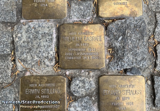
EP17 - #RightNow Frankfurt: Stolpersteine (Part 1) (August 1st 2020)
During the Nazi empowerment in the 1930s and 1940s thousends of Jewish families and immigrants have lost their property through expropriation. This also happened in Frankfurt, a the city with the second biggest Jewish community in the 1930s. This is a time travel to remember the names of the people lost their home, their lives, their families, their dignity through a regime contemptuous of human beings and race.
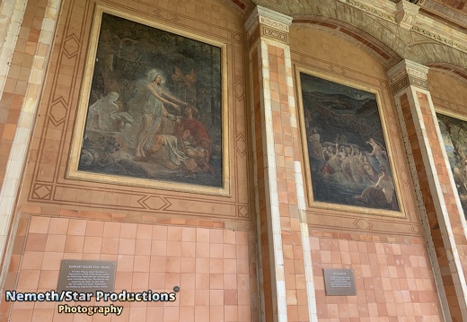
EP18 - #RightNow Baden-Baden: Trinkhalle (August 2nd 2020)
The Trinkhalle (pump house) in the Kurhaus spa complex in Baden-Baden was built 1839–42 by Heinrich Hübsch in a complementary architectural style as the spa's main building. The 90-metre arcade is lined with frescos and benches. The spa waters are said to have curative powers. Source Text: https://en.wikipedia.org/wiki/Trinkhalle_(Baden-Baden)
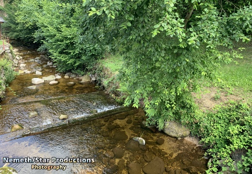
EP19 - #RightNow Baden-Baden: Geroldsauer Wasserfall
We are on our journey to the Geroldsau Waterfall in the Northern Black Forest. The Grobbach rises on the rainy western slopes of the northern Black Forest at a height of about 800 m above NN on the Black Forest High Road near Plättig/Bühlerhöhe. The river flows northwards and merges before the waterfall with the Harzbach, which, together with its two tributaries, drains the northwestern slopes of the Badener Höhe. At the waterfall the Grobbach has an average flow rate of 0.56 m³/s. The Geroldsau Waterfall is a roughly six-metre-high waterfall on the Grobbach stream south of the Baden-Baden quarter of Geroldsau. The water drops here from about 291 m above NHN down to about 285 m. into a small rock bowl. After about a kilometre the V-shaped valley widens into the broad valley bottom of Geroldsau. At its confluence with the Oos in Lichtental the Grobbach is bigger and longer than the Oos. Text: https://en.wikipedia.org/wiki/Geroldsau_Waterfall
EP20 - #RightNow Baden-Baden: Merkurberg
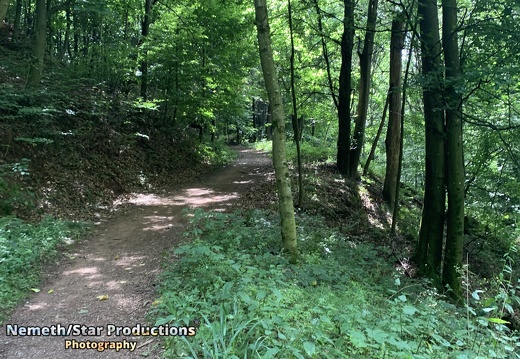
The Merkur or Großer Staufenberg is a mountain, 668.3 m above sea level, in the Northern Black Forest, Germany. It is the Hausberg of Baden-Baden and located between the spa town and the town of Gernsbach. The Merkur is a popular launch site for paragliders The mountain is named after the Ancient Roman god of trade and commerce, Mercury, to whom a Roman votive stone on the summit is dedicated.The Merkurstein has been recorded since the 16th century. Today, there is a cast of the original votive stone on the summit plateau; its prototype is in the Baden-Baden Municipal Museum collection. An observation and radio tower stands on the highest point of the Merkur. It was built in 1837 and was raised in height when the funicular was built. Since the 1950s it has also acted as a radio broadcast transmitter. A more recent reinforced concrete annex supports an antenna mast made of steel, reaching a total height of 63 metres. The original name of the free-standing conical mountain was the Großer Staufenberg, a reference to the shape of a turned drinking mug known as a Stauf. At the top station is a restaurant. Other attractions at the summit include a sunbathing lawn, a barbecue area and a play park with giant slide. Aimed at spa guests, but usable by anyone, are the so-called “terrain spa walks” (Terrainkurwege) of different lengths and gradients. One of these paths leads to the wildlife park at the foot of the mountain where there are red deer, fallow deer and mounflon. About half-way up the Merkur on the Baden-Baden side is the premium footpath, the Panorama Way (Panoramaweg). The summit of the Merkur is a waystop on two other premium footpaths: the Gernsbacher Runde and Murgleiter.The mountain has an all-round view, not just over the bowl of Baden-Baden, the highest peaks of the Northern Black Forest and the Murg valley with the towns of Gaggenau and Gernsbach, but also of the Upper Rhine Plain, the Vosges, the Haardt and the Odenwald. In the field of view are the ruins of Hohenbaden Castle, the Battert rocks, the ruins of Alt Eberstein, the Fremersberg, the Yburg, the Badener Höhe and the Hornisgrinde as well as the cities of Karlsruhe and Strasbourg. Text from Wikipedia: https://en.wikipedia.org/wiki/Merkur_(mountain)
EP21 - #RightNow Frankfurt: Garten des Himmlischen Friedens
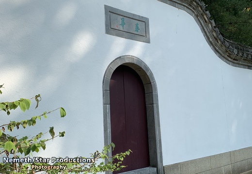
The garden is part of the Bethmannpark located in the Nordend. The main entrance is located near the entrance of the Bethmannpark at the beginning of Berger Straße.The city of Frankfurt began in 1985 with the realization of its own Chinese Garden in Bethmannpark, where the family of the same name had already planted and bred East Asian plants two hundred years ago. The Shuikou Gardens from Huizhou were the model for this. The buildings are based on the style of simple residential houses from the province of Anhui.In 27 containers, building materials were brought in from China by sea; the construction was carried out by 16 Chinese skilled workers who had travelled there especially for this purpose. After four years of construction and a total investment of DM 3.2 million, the park was opened on October 7, 1989 as a spring flower garden. Only a few weeks later, in memory of the Tian’anmen massacre on June 4, 1989, it received its present name Garden of Heavenly Peace. The central element of the 4,000 m² park, which is surrounded by a wall, is the asymmetrical branched jasper green pond. Behind the lion-guarded main gate, the bridge of the half boat leads across it to the rectangular water pavilion. On its other side, the Gallery of Scented Water runs along the pond’s shore and finally ends at the square mirror pavilion. The visitor crosses the zig-zagging Jade Belt Bridge to reach the north bank. To the west, the bridge offers a view of a rock with a waterfall. The southern part of the garden - beyond the water pavilions - is dominated by a hill on which the pavilion rises in shimmering green. In addition, a multitude of plants, bushes, rocks, stones, waterfalls and characters are scattered throughout the park. Their arrangement was not left to chance, but rather reflects various references - especially to the Chinese symbolic language. Text: https://de.wikipedia.org/wiki/Garten_des_Himmlischen_Friedens
EP22 - #RightNow Frankfurt: Bethmann Weiher
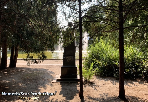
The Bethmann family has been remarkable for the high proportion of its male members who succeeded at mercantile or financial endeavors. This family trait began in medieval northern Germany and continued with the Bethmann bank, which Johann Philipp Bethmann (1715–1793) and Simon Moritz Bethmann (1721–1782) founded in 1748 and soon catapulted into the foremost ranks of German and European banks. Even after the bank’s sale in 1976, there are Bethmanns engaged in commercial real estate and forestry in the 21st century. Simon Moritz Bethmann (1721 – 1782) was a German merchant and banker. In 1755 Simon Moritz became deacon of the Niederländische Gemeinde Augsburgischer Confession (= Dutch Congregation of the Augsburg Confession), a charitable institution transferred to Frankfurt in 1585 by Martinist Lutherans who had fled Antwerp’s religious persecution. Together with Johann Philipp he purchased the Basler Hof property from the Patrizier Johann Friedrich Maximilian von Stalburg, where the Bethmann bank maintains offices to this day. Text: Wikipedia https://en.wikipedia.org/wiki/Bethmann_family https://en.wikipedia.org/wiki/Simon_Moritz_Bethmann
EP23 - #RightNow Frankfurt: Around Willy-Brandt-Platz
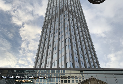
The Willy-Brandt-Platz is a central square in Frankfurt am Main, Germany. Its name was Theaterplatz (Theatre square) until 1992, when it was named after Willy Brandt, the former chancellor. It is located between the Main Station and the Altstadt, at the Frankfurter Anlagenring, and is part of the so-called Bankenviertel. Major buildings are the Städtisches Opern- und Schauspielhaus, the municipal theatre that opened in 1963, and the Eurotower skyscraper. Below the square are the U-Bahnhof Willy-Brandt-Platz and the Theatertunnel street tunnel.In the Gallusanlage, north of the square, one of two copies of the monumental sculpture Euro-Skulptur by Ottmar Hörl dominates the park. The 14 m high, 50-ton sculpture, consisting of a blue euro sign surrounded by twelve yellow stars representing the first member nations of the European Union, is illuminated at night by 330 neon light strips. The acrylic glass sculpture was installed in 2001. A sculptured fountain, Märchenbrunnen (Fairy-tale Fountain), created by Friedrich Christoph Hausmann in Jugendstil, is placed next to the opera house.The square is open for pedestrians, the tram, cars, and the U-Bahn below it. Cars were preferred, which led to less flexibility for other parties. The building of the Theatertunnel in 1974 helped to reduce car traffic significantly. From 2004, when an underground parking lot below the square was completed, it was remodelled to ensure accessibility for handicapped people of public institutions. At the same time, a new lighting system was installed. Text: Wikipedia https://en.wikipedia.org/wiki/Willy-Brandt-Platz


